
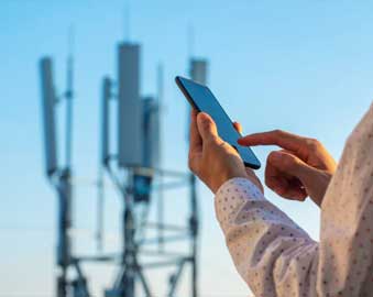
How a GPS Tracker Uses GPS Communication
![]()
The Key Takeaways:
✅ Satellites determine location; cellular networks send the data to you.
✅ Real-time GPS trackers use both GPS and cellular networks for live tracking.
✅ BrickHouse Security upgraded to Verizon’s 4G LTE for better reliability and coverage.
✅ Tracking costs stay low because GPS devices send only small data packets.
Understanding How GPS Tracker Works
Many people assume that GPS trackers work the same way as car navigation systems or smartphones using maps. However, while both use GPS (Global Positioning System) satellites to determine location, GPS trackers don’t just receive signals—they also send data to you.
If you’ve ever wondered how your GPS tracker knows where it is and how it sends that information to you, this guide will explain everything in simple terms.
At its core, your GPS tracker works like a two-part system:
-
Finding location: It connects to GPS satellites through a GPS receiver to determine its position.
-
Sending location data: It uses cellular networks to transmit that information to an app or online platform.
This combination of satellite technology and cellular communication is what makes real-time GPS tracking possible. Let’s break it down further.
Satellites vs. Cellular Networks: What’s the Difference?
A common misunderstanding is that GPS trackers communicate entirely via satellites. In reality, most trackers rely on both satellites and cellular networks to function properly.
-
GPS satellites determine the tracker’s exact location. GPS trackers receive gps satellite signals to determine their location.
-
Cellular networks (like Verizon, AT&T, or T-Mobile) send that data to your phone or computer.
Imagine you’re using Google Maps on your phone:
-
The GPS chip in your phone locks onto satellites to determine your location.
-
Your phone uses the internet (WiFi or cellular data) to load the map and display your position.
GPS trackers work the same way! They “see” satellites to find location but need a cellular connection to send that data back to you.
Satellite-Only Trackers vs. Hybrid GPS Trackers
While most trackers use a combination of GPS and cellular networks, there are some satellite-only trackers used in special situations.
Satellite-Only Trackers
-
Transmit data exclusively via satellites (no cellular networks involved).
-
Used for extreme remote locations—oceans, deserts, mountains, and off-grid areas.
-
Some satellite-only trackers use the Globalstar satellite network, which may impact communication speed and reliability.
-
Higher cost due to expensive satellite communication fees.
-
Often used for government, military, or large-scale business operations.
Hybrid GPS Trackers (use satellite network both)
-
Finds location using GPS satellites.
-
Transmits data using cellular networks.
-
Some hybrid GPS trackers use the Iridium satellite network for reliable global coverage.
-
Most consumer and business GPS trackers fall into this category.
-
More affordable than satellite-only devices.
Unless you’re tracking in completely remote locations with no cell coverage, a hybrid GPS tracker is the best choice for real-time monitoring.
Why BrickHouse Security Upgraded to Verizon’s 4G LTE Network
BrickHouse Security recently transitioned from GSM networks to Verizon’s 4G LTE for better coverage and reliability.
What This Means for You:
✔ Faster and more reliable tracking updates—No more dropped signals.
✔ Stronger nationwide coverage—Track in more places with confidence.
✔ Future-proof technology—4G LTE will be supported for years to come.
Active vs. Passive GPS Trackers: What’s the Difference?
Not all GPS trackers work the same way. There are two main types passive and active GPS trackers.
Passive GPS Trackers (GPS Data Loggers)
![]()
-
Think of these like a black box in an airplane—they record data but don’t transmit it.
-
They store location history internally.
-
To view the data, you must physically retrieve the device and download it to a computer.
-
No real-time tracking—only historical data.
Active GPS Trackers (Real-Time Trackers)
-
These work like a smartphone’s GPS app—they constantly send location updates.
-
They receive satellite signals and send location updates over a cellular network.
-
You can track them live through an app or website.
-
Used for tracking vehicles, fleets, assets, and people in real-time.
Since only active GPS trackers rely on cellular networks, they are the ones affected by network upgrades—such as BrickHouse Security’s switch to Verizon.
How GPS Trackers Receive Location Data from GPS Satellite Signals
Your GPS tracker determines its location using a system of satellites called the Global Navigation Satellite System (GNSS). The GPS constellation consists of multiple satellites working together to provide precise location data.
Here’s how it works:
-
Satellites send out signals containing location and time information.
-
Your GPS tracker picks up signals from at least four satellites to calculate its exact position.
-
Using triangulation, the tracker determines its precise latitude, longitude, speed, and direction.
At any given time, there are about 30 active GPS satellites orbiting the Earth, ensuring global coverage.
Fun fact: GPS satellites are equipped with atomic clocks to ensure ultra-precise timekeeping—accurate to billionths of a second!
How GPS Trackers Send Location Data to You via Satellite Communication
Once your tracker knows its location, it needs to send that information to your tracking platform (app or website).
This is done through cellular networks like Verizon’s 4G LTE. Maintaining a strong cell signal is crucial for reliable data transmission from the GPS tracker to your device.
What Data Is Sent?
Each update includes:
✅ GPS coordinates (latitude & longitude)
✅ Speed & direction
✅ Time & date
✅ Alerts (e.g., geofence entry/exit, motion detection, panic button)
How Often Does a GPS Tracker Send Data?
-
Many real-time GPS trackers update every 60 seconds (customizable for battery life).
-
Some high-performance models can update as frequently as every 5-10 seconds for more precise tracking.
Because GPS trackers send small amounts of data, they don’t require strong cellular signals like video streaming or phone calls. Even in areas with weaker cell reception, your tracker can still transmit location updates.
Why GPS Trackers Keep Data Costs Low
GPS tracking might sound like a data-heavy process, but it’s actually very efficient.
- Instead of streaming video or large files, GPS trackers send tiny packets of location data.
- These packets are processed and displayed in BrickHouse’s GPS tracking platform.
- Since data use is minimal, monthly tracking costs remain affordable.
By optimizing how location information is collected, transmitted, and displayed, GPS trackers offer real-time monitoring without high data costs.
Final Thoughts: Why GPS Trackers Are So Effective
GPS tracking is one of the most reliable, cost-effective ways to monitor vehicles, assets, and loved ones.
At BrickHouse Security, we’re committed to offering the best real-time GPS tracking solutions—helping you protect what matters most.
? Need a GPS tracker? Browse our latest GPS Trackers model here.
Posted by Kellie Kendall on Mar 29th 2024