
How Accurate Is GPS Tracking?
GPS tracking has become woven into our daily lives, from navigating unfamiliar cities to monitoring fleet vehicles across continents. Yet one question consistently surfaces: just how accurate is GPS tracking, really? Whether you’re tracking a delivery truck, locating a lost pet, or simply trying to find the nearest coffee shop, understanding what GPS can and cannot deliver helps you make better decisions about the technology you rely on.
How Does GPS Tracking Work?
The Global Positioning System started as a U.S. Department of Defense project in the late 1970s and became fully operational in the 1990s. Today, it powers modern navigation and every GPS tracker used for vehicles, assets, and personal tracking worldwide.
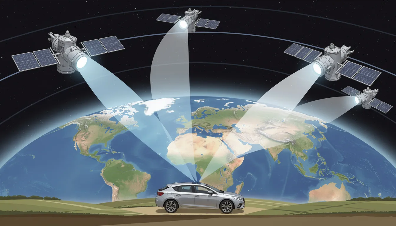
More than 30 GPS satellites orbit Earth at approximately 20,200 kilometers (12,550 miles) altitude, continuously broadcasting precise time and orbital data. These satellite signals travel at the speed of light, and your GPS receiver measures exactly how long each signal takes to arrive.
Here’s how your device calculates your exact position:
- GPS receiver picks up signals from at least four satellites simultaneously
- It measures the precise travel time of each signal
- Using a method called triangulation (technically trilateration), it calculates the intersection point of spherical ranges from each satellite
- This process determines your latitude, longitude, altitude, and the precise time
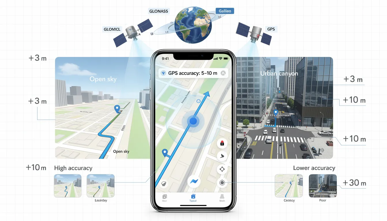
Modern GPS enabled devices typically don’t rely on GPS alone. They combine signals from multiple GNSS constellations including Galileo (European), GLONASS (Russian), and BeiDou (Chinese). Many also use assisted GPS, which leverages cellular network data and Wi-Fi positioning to speed up location fixes and improve reliability.
Once your tracker calculates its position, it transmits this GPS data via mobile networks to a server or app, where you see the live location displayed on mapping software like Google Maps.
The raw accuracy of GPS depends on several factors: timing errors in signal transmission, satellite orbit data precision, and how clearly your receiver can “see” the sky above.
What Determines GPS Tracking Accuracy?
GPS signals broadcast from space are extremely precise. However, real-world GPS accuracy depends on the environment around your device, the hardware quality, and the software processing the data.
Several key factors affect GPS accuracy:
|
Factor |
Impact on Accuracy |
|---|---|
|
Satellite geometry (DOP) |
Poor geometry can double or triple position errors |
|
Signal blockage |
Buildings, terrain can cause 10-50m errors |
|
Atmospheric effects |
Ionosphere/troposphere delays add 2-10m errors |
|
Multipath reflections |
Signals reflected off surfaces distort position |
|
Receiver quality |
Varies from 20m (basic) to sub-meter (high-end) |
|
Update frequency |
Affects track smoothness, not individual fix accuracy |
“Good geometry” means GPS satellites are spread widely across the sky. When satellites cluster in one area, measured by Dilution of Precision (DOP), accuracy suffers. A PDOP above 6 indicates poor geometry that can greatly increase errors.
Atmospheric conditions like ionospheric and tropospheric delays also affect accuracy by slowing GPS signals, causing meter-level errors unless corrected by dual-frequency receivers or augmentation systems. Consumer devices typically don’t fully correct these, resulting in practical accuracy of 3-10 meters rather than sub-meter precision.
Environmental and Signal Conditions
The physical environment is often the biggest reason GPS shows you in the “wrong” place. Various factors cause location data to vary:
- Urban canyons in cities like New York cause tall buildings to block or reflect satellite signals, shifting your position by 10-50 meters.
- Indoors or underground, GPS signals weaken, forcing devices to rely on Wi-Fi or cell towers, reducing accuracy from meters to potentially hundreds of meters.
- Natural obstructions like dense forests and mountains limit satellite visibility, degrading accuracy.
- Weather and atmospheric conditions, such as storms and solar activity, can add a few meters of error but rarely disrupt GPS completely.
Device and Receiver Quality
Not all GPS receivers are created equal. The quality of the chipset and antenna design greatly affects GPS accuracy.
- Modern flagship smartphones (2022-2024) often support multiple GNSS constellations and dual GPS frequencies (L1 and L5), improving accuracy by correcting ionospheric delays. Cheaper or older devices typically use a single frequency and fewer constellations, resulting in slower fixes and errors of 10-20 meters even in open spaces.
- Dedicated GPS trackers and vehicle units usually offer better performance with optimized antennas, firmware, and consistent 1-3 meter accuracy under clear skies. Position update rates also impact tracking smoothness.
For example, a tracker placed under a vehicle dashboard may lose accuracy due to signal blockage compared to one mounted externally with a clear sky view.
Software, Maps, and Address Data
Sometimes the GPS position is perfectly accurate, but errors arise from the app’s map or address database. This often leads users to mistakenly blame GPS when the issue is actually with mapping software.
Map matching can cause apparent errors by snapping GPS coordinates to the nearest road, which may place you on the wrong street or building in dense areas.
Geocoding errors mean addresses are often approximated along a street segment rather than pinpointed at precise entrances, explaining why navigation apps may say “you’ve arrived” when you’re still a few houses away.
Outdated maps worsen these problems, especially in rapidly changing areas with new roads or buildings. Different apps may show varying locations for the same GPS coordinates due to reliance on different map databases.
How Accurate Is GPS in Practice?
Understanding “how accurate is GPS tracking” requires looking at specific device types and applications. The tracking device you use and what you’re doing with it dramatically affects the accuracy levels you’ll experience.
Here’s a practical breakdown of approximate accuracy under good open sky conditions:
|
Device Type |
Typical Accuracy |
Best-Case Accuracy |
|---|---|---|
|
Smartphones |
5-8 meters |
3-5 meters |
|
Consumer GPS trackers |
3-5 meters |
1.5-3 meters |
|
Vehicle/fleet trackers |
3-5 meters |
1-3 meters |
|
High end devices (survey) |
0.5-1 meter |
1-2 centimeters |
These figures assume favorable conditions. In obstructed environments, all devices see degraded performance, though better accuracy units with higher receiver quality degrade less.
Smartphones and Everyday Navigation Apps
Android and iOS devices typically report horizontal accuracy of about 4-8 meters outdoors, with marketing often citing 4.9 meters (16 feet) under open sky. This level of accuracy is sufficient for most navigation needs.
Apps like Google Maps and Apple Maps use both GNSS signals and network-based positioning. When satellite signals weaken, they rely on cell towers and Wi-Fi to estimate location, which reduces accuracy.
In cities, GPS signals can reflect off tall buildings, causing your phone to show locations across the street or on nearby blocks. This effect, known as multipath, leads to the familiar “blue dot dance” in urban areas.
Since around 2018, support for dual-frequency GPS (L1 + L5) in high-end phones has improved navigation accuracy, enabling lane-level guidance on some highways. However, smartphone GPS is still not precise enough for tasks requiring exact stops at parking bays or property corners. If your device tells you’ve arrived but you’re still a few houses away, this limitation is the reason.
Standalone GPS Trackers and Vehicle Units
Dedicated GPS trackers for vehicles, fleets, and assets prioritize reliability and generally achieve better accuracy than smartphones. These devices are purpose-built for tracking rather than being general-purpose computers with GPS added.
Many consumer and fleet trackers advertise 1.5-3 meter accuracy in open-sky conditions. Actual performance depends heavily on antenna placement and network connectivity. The difference between a tracker mounted externally versus one hidden inside a vehicle can be several meters of accuracy.
Key accuracy factors for standalone trackers:
- Antenna placement: Roof or windshield mounts outperform dashboard installations
- Multi-constellation support: GPS + GLONASS + Galileo provides more satellites and better geometry
- A-GPS capability: Faster fixes and improved urban performance
- Update frequency: More frequent position calculations enable smoother real time location data
For fleet management applications, 3-5 meter accuracy is typically sufficient. Dispatchers can determine which road a vehicle is on, what address it’s near, and whether it’s at a customer site or depot. This level of accurate location data supports most operational needs.
Professional, Survey-Grade, and Special Applications
Professional applications require much higher accuracy than typical consumer devices. Surveying, precision agriculture, and construction use differential GPS (DGPS) or Real-Time Kinematic (RTK) corrections to achieve precision within 1-2 centimeters.
These systems work by using ground stations at known locations to calculate errors and send correction data to GPS receivers, significantly reducing positional errors from meters to centimeters.
Examples include farmers guiding tractors precisely, surveyors marking boundaries, and scientists monitoring earth movements.
However, this high accuracy comes with higher costs, need for specialized equipment, and expert setup, making it unnecessary for everyday consumer tracking.
Why Does GPS Sometimes Show Me in the Wrong Place?
You’ve likely experienced the frustration: your blue dot jumps around erratically, navigation routes you to the back of a building, or your position appears off by a block. These issues are common and usually have explainable causes.
GPS position errors typically stem from three broad categories:
- Signal and environment issues: Buildings, terrain, and atmospheric conditions
- Device limitations: Antenna quality, chipset capabilities, and processing power
- Mapping and data problems: Outdated maps, incorrect addresses, aggressive road-snapping
The raw satellite signal is often extremely accurate, user range error typically averages below 2 meters. However, your end-user experience is shaped by how all these real-world complications interact.
Experienced users check whether inaccuracy is consistent across apps and locations. If your position is wrong everywhere, it might be a device issue. If it’s only wrong in certain areas, environment is likely the culprit. If one app is wrong but another is correct, blame the mapping data.
Common Technical Causes of Position Errors
GPS position errors usually happen because of blocked satellites, signal reflection, hardware limits, or temporary system factors.
Limited Satellite Visibility:
GPS accuracy depends on signals from at least four satellites to calculate a 3D position. When buildings, mountains, or terrain block part of the sky, your device sees fewer satellites. If the visible satellites cluster in one area instead of spreading evenly overhead, positioning geometry weakens and errors can double or triple.
Multipath Interference
Multipath interference happens when GPS signals bounce off buildings, vehicles, or water before reaching your receiver. Because the reflected signal travels a longer path, the device calculates the wrong distance. Dense city environments create this issue constantly, which explains why location pins often drift or jump in downtown areas.
Receiver Limitations
GPS receiver quality also affects accuracy. Older or low-cost chipsets struggle in complex environments and take longer to stabilize. This can cause “wandering” location tracks, even when you’re standing still.
System Maintenance Events
Occasionally, satellite maintenance or minor anomalies affect GPS performance. The U.S. Space Force publishes status updates when this happens. Major disruptions are rare, but small timing variations can slightly reduce accuracy.
Quick Diagnostic Tip
Move into an open area away from tall buildings and wait a few minutes. If your GPS position stabilizes, the environment caused the error, not the device itself.
Mapping, Address, and App-Level Issues
Navigation apps combine GPS coordinates, map data, and routing software. Errors in any of these layers can make GPS seem inaccurate even if the signal is correct. Geocoding may place addresses at property centers instead of entrances, causing delivery confusion.
Outdated maps can show missing roads or renamed streets, leading to wrong routes. Road-snapping algorithms may shift your location to nearby roads, making it appear off-course. To verify accuracy, check a second app or use satellite view to distinguish GPS errors from map data issues.
How Accurate Is GPS for Speed and Timing?
GPS speed accuracy is typically more precise than GPS position accuracy. While most people focus on location in meters, speed and timing calculations rely on signal behavior that produces tighter results.
GPS calculates speed in two ways:
By measuring how position changes between updates and by analyzing Doppler shift in the satellite signal. The Doppler method measures velocity directly from signal frequency changes, which allows highly precise speed readings even when position data fluctuates slightly.
According to U.S. GPS performance standards, user range rate error is about 0.006 meters per second over three seconds, 95% of the time. In practical terms, that supports very accurate speed tracking across vehicles, sports devices, and fleet systems.
GPS speed accuracy supports:
- Vehicle tracking and regulatory compliance
- Sports and fitness performance tracking
- Speed-limited fleet management
- Aviation and maritime navigation
GPS timing precision is even stronger. Satellite clocks stay synchronized within tens of nanoseconds of UTC. Dedicated receivers can align communication networks and power grids within roughly 30 nanoseconds. Consumer devices don’t display this level of precision, but they depend on it for reliable timestamps and transaction security.
Why GPS Speed Readings Are Often More Reliable Than Position
GPS speed readings are more stable because they average changes across multiple updates. Short-term position jumps or signal noise have less impact on calculated velocity.
Under stable, open-sky conditions, GPS vehicle speed is commonly accurate within ±0.2 to 0.5 mph. In many cases, that rivals or exceeds wheel-based sensors, which can drift due to tire wear or calibration issues.
Typical GPS Accuracy Levels
|
Measurement |
Typical Performance |
|---|---|
|
Position (horizontal) |
3-10 meters |
|
Speed |
±0.2-0.5 mph |
|
Timing |
30-100 nanoseconds |
Accuracy can drop at very low speeds. When walking or jogging in areas with trees or tall buildings, small position shifts may cause pace readings to fluctuate.
For legal enforcement, radar and lidar remain the primary speed measurement tools. GPS speed data supports monitoring and tracking but is not the standard for issuing citations in most jurisdictions.
Improving GPS Tracking Accuracy
You can improve GPS tracking accuracy by reducing environmental interference or using correction systems designed for higher precision. Some factors remain outside your control, but several practical steps make a measurable difference.
For professional use cases such as surveying, aviation approaches, and maritime navigation, regulations already require specialized equipment. For everyday users and fleet managers, improvements range from simple placement adjustments to advanced correction networks.
Advanced Correction Methods: DGPS, RTK, and SBAS
When standard GPS accuracy is not enough, correction technologies reduce positioning error significantly.
Differential GPS (DGPS)
Differential GPS (DGPS) uses fixed ground stations at precisely surveyed locations. These stations calculate common satellite and atmospheric errors, then transmit correction data to nearby receivers. DGPS can reduce typical 5-10 meter accuracy down to roughly 0.5-1 meter within coverage areas.
Real-Time Kinematic (RTK)
Real-Time Kinematic (RTK) processing uses carrier-phase measurements to achieve centimeter-level accuracy. Within about 10-20 kilometers of a base station, RTK systems can maintain positioning within 1-2 centimeters. Precision agriculture relies on this method to keep tractors aligned accurately across large fields.
Satellite-Based Augmentation Systems (SBAS)
Satellite-Based Augmentation Systems (SBAS) broadcast correction signals through geostationary satellites. These systems improve civilian GPS accuracy without requiring local base stations.
SBAS Coverage by Region
|
System |
Coverage Area |
|---|---|
|
WAAS |
North America |
|
EGNOS |
Europe |
|
MSAS |
Japan |
|
GAGAN |
India |
Aviation has depended on these systems for instrument approaches since the early 2000s.
Some commercial GPS tracking providers offer RTK subscriptions or access to national correction networks. These setups require additional hardware or service fees and are typically used in professional environments rather than standard consumer tracking.

Is Military GPS More Accurate Than Civilian GPS?
A persistent myth suggests that governments deliberately limit civilian GPS accuracy while keeping “better” GPS for military use. This hasn’t been true for over two decades.
Historical context: Before May 2000, the U.S. government intentionally degraded civilian GPS accuracy through a policy called Selective Availability (SA). This limited civilian users to approximately 100 meters of accuracy while military receivers could achieve much better precision.
Current reality: Selective Availability was permanently switched off on May 2, 2000. The U.S. government has repeatedly stated it has no plans to reinstate it. Today, both civilian and military users receive the same core GPS signals.
Military GPS advantages in 2024 aren’t about “better coordinates”, they focus on:
- Encrypted signals resistant to spoofing
- Anti-jamming capabilities
- Resilience against electronic warfare
- Secure military-only frequencies
Civilian dual-frequency receivers with augmentation can actually achieve equal or better accuracy than many military applications. Survey-grade civilian equipment routinely delivers centimeter precision that exceeds typical military operational needs.
The main limits on your GPS accuracy today are environment and hardware, not policy.
Real-World Impacts of GPS Tracking Accuracy
GPS tracking accuracy affects logistics, law enforcement, safety systems, and daily navigation. The difference between 2 meters and 10 meters may seem small, but operationally it can change outcomes.
Industries where GPS accuracy matters most include:
- Fleet management: Route planning, delivery verification, driver compliance
- Emergency response: Locating crash scenes and dispatching responders
- Agriculture: Precision planting, fertilizer control, yield mapping
- Construction: Equipment positioning and site grading
- Scientific research: Monitoring tectonic shifts, glaciers, and sea levels
In legal and forensic cases, GPS logs help establish where a vehicle or device was at a specific time. Investigators review this data carefully and account for possible margin of error before drawing conclusions.
Navigation, Fleet, and Asset Management
Fleet operations rely on GPS accuracy of 3-5 meters for efficient dispatch and tracking. This enables route optimization, accurate ETAs, proof of delivery, and speed monitoring, reducing fuel waste and improving safety.
Yard management benefits from sub-5-meter accuracy by quickly locating trailers and containers, saving time. Geofencing uses buffer zones of 10-15 meters to avoid false alerts.
For stolen vehicles or valuable assets, detailed GPS history aids recovery and insurance claims.
Safety, Emergency Response, and Personal Use
Emergency services rely on GPS-based location data from mobile devices and vehicle telematics to respond quickly.
Even a 10-20 meter difference can determine whether responders reach:
- The correct side of a highway
- The main entrance instead of a rear loading area
- The right building in a complex
Personal safety devices track children, elderly family members, and lone workers. In many cases, identifying the correct building or property provides enough precision to act quickly.
Outdoor users depend on 3-10 meter accuracy to:
- Record routes and distances
- Track pace and performance
- Share live locations
- Provide coordinates during emergencies
In search-and-rescue operations, even 20-meter GPS accuracy significantly narrows the search area compared to having no data. Combined with terrain analysis, call logs, and witness reports, GPS information strengthens the overall investigation rather than serving as the sole source of truth.
Conclusion
So, how accurate is GPS tracking?
Under open sky, most smartphones and consumer GPS trackers deliver 3-10 meter accuracy, while dedicated vehicle units often perform closer to 1-3 meters. In real-world conditions, cities, parking garages, forests, accuracy drops because of signal blockage, reflections, and map data limitations.
For navigation, fleet tracking, safety monitoring, and everyday use, that level of accuracy is more than enough. For surveying or precision agriculture, correction systems like RTK bring accuracy down to centimeters.
In short: GPS is highly reliable for practical use. When errors appear, the environment or mapping software is usually the cause, not the satellites.
Frequently Asked Questions
How accurate is GPS tracking in meters?
Most consumer GPS devices are accurate within 3-10 meters in open outdoor conditions. Dedicated vehicle or fleet trackers often perform closer to 1-3 meters with clear sky visibility.
Why does GPS sometimes show the wrong location?
GPS errors usually happen because of:
-
Tall buildings blocking or reflecting signals
-
Indoor or underground use
-
Dense trees or mountains
-
Outdated map or address data
In many cases, the GPS signal is correct, but the mapping app places the pin incorrectly.
Is GPS more accurate on a dedicated tracker than a smartphone?
Yes, often. Dedicated GPS trackers use optimized antennas and consistent positioning logic. Smartphones balance GPS with battery life, Wi-Fi positioning, and cellular data, which can reduce accuracy in some environments.
How accurate is GPS for speed?
GPS speed is typically accurate within ±0.2 to 0.5 mph under stable conditions. Speed calculations rely on Doppler measurements, which are often more precise than position readings.
Can weather affect GPS accuracy?
Severe storms and solar activity can add a few meters of error, but weather rarely causes total GPS failure. Buildings and terrain usually have a much larger impact than weather.
Can GPS be accurate to a few centimeters?
Yes, but only with specialized systems like RTK (Real-Time Kinematic) or DGPS corrections. These setups require additional equipment and are used in surveying, agriculture, and construction, not typical consumer tracking.
Posted by Kellie Kendall on Mar 6th 2026