
What is a GPS Tracker and How Does it Work?
GPS tracking has become one of those technologies that quietly runs in the background of modern business and daily life. From the delivery van bringing your package to the construction equipment sitting at a remote job site, millions of vehicles and assets are being monitored in real time. But what exactly makes this possible?
In this guide, you’ll learn what a GPS tracker actually is, how the underlying technology works, the different types available, and the practical benefits for businesses and individuals alike.
What is a GPS tracker?
A GPS tracker is a small electronic device that uses satellite signals to determine and transmit the real-time location of a vehicle, asset, or person. It combines a GPS receiver with communication hardware to send location data to an app, web platform, or central server where you can monitor movements.
GPS stands for Global Positioning System, a satellite-based navigation network originally developed by the United States Air Force and fully operational since 1993. Today, it’s available free of charge to anyone with a compatible receiver.
Modern GPS trackers typically combine GPS satellite data with cellular networks to send live location information to a tracking platform. When a dispatcher in February 2026 sees a delivery van’s exact position on their screen and watches it move in real time, that’s a GPS tracker at work.
Here’s what you need to know at a glance:
- A GPS tracker is essentially a GPS receiver bundled with a cellular or satellite modem that transmits location data
- The device calculates its position using signals from GPS satellites orbiting Earth
- Most trackers send data over 4G/5G cellular networks to cloud-based software
- Users access location data through web dashboards or mobile apps
- Tracking intervals can range from every few seconds to several hours, depending on the configuration
What is GPS and how does it relate to a tracker?
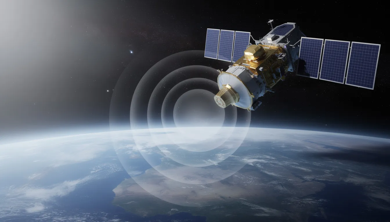
To understand how a GPS tracker works, you first need to understand the system it relies on. GPS is a global satellite navigation system operated by the U.S. Space Force, consisting of 31-32 active satellites orbiting Earth at approximately 20,200 kilometers altitude.
The GPS system is divided into three segments that work together to provide positioning, navigation, and timing services worldwide:
- Space segment: The constellation of GPS satellites circling Earth, each broadcasting precise time and position signals using onboard atomic clocks accurate to within one second every 300,000 years
- Control segment: A network of ground stations and master control stations that monitor satellite health, update orbital data, and make corrections to keep the system accurate
- User segment: All the GPS receivers on Earth, from smartphones and car navigation systems to dedicated tracking devices
GPS satellites continuously broadcast radio signals containing their exact position and the precise time. Any GPS receiver within line-of-sight can pick up these signals and use them to calculate its own position.
A GPS tracker is essentially a GPS receiver bundled with additional hardware. While your smartphone’s GPS receiver only calculates position when you open a map app, a GPS tracker continuously determines its location and actively transmits that data. Most commercial GPS tracking devices include:
- A GPS receiver chip to acquire satellite signals
- A cellular modem (4G LTE or 5G) to transmit data
- Sometimes additional sensors like accelerometers or connections to vehicle diagnostic systems
How does a GPS tracker work?
The process behind GPS tracking involves a chain of events: satellites send signals, the tracker calculates its position using a method called trilateration, the tracker transmits data via a cellular or satellite network, and finally the user sees the device’s location displayed on software or an app.
Understanding this process helps you appreciate both the power and the limitations of GPS technology. Here’s how it works step by step:
- Step 1: Satellite signal acquisition – GPS satellites continuously broadcast signals containing their position and precise atomic clock time. Your tracker’s antenna picks up these radio signals from multiple satellites simultaneously.
- Step 2: Distance calculation – The tracker measures how long each satellite signal took to arrive. Since the signals travel at the speed of light (299,792.458 km/s), the receiver can calculate the distance to each satellite based on the time delay.
- Step 3: Trilateration – Using distances from at least four satellites, the tracker applies geometry to pinpoint its exact location in three-dimensional space (latitude, longitude, and altitude). Four satellites are needed because the receiver must also account for tiny timing errors in its own internal clock.
- Step 4: Data packaging – The tracker records the coordinates along with a timestamp, speed, heading, and sometimes additional telemetry like ignition status or engine data.
- Step 5: Transmission – The tracker sends this data package to a central tracking portal or cloud server using its built-in cellular modem and SIM card (or satellite modem for remote areas).
- Step 6: Display – The tracking software processes the incoming data and displays the vehicle or asset’s position on a map, often with a historical trail showing recent movements.
Most GPS tracking hardware records position at intervals ranging from every 10 seconds to every few minutes, depending on configuration and use case. When cellular networks are unavailable, many trackers buffer location data internally and upload the complete trip history once connectivity returns.
Active vs. passive GPS trackers
GPS trackers are commonly categorized as “active” (real-time) or “passive” (data-logging) based on how and when they share location data. Understanding this distinction helps you choose the right solution for your needs.
Active GPS trackers continuously or frequently send live location and status data over a network. This allows users to see movement in real time on a dashboard or receive instant alerts when certain events occur.
- Require ongoing cellular or satellite connectivity
- Typically involve monthly service fees for data transmission
- Best for scenarios requiring immediate visibility, like fleet tracking or theft recovery
- Example: A long-haul truck sending position updates every 30 seconds so dispatchers can provide accurate ETAs to customers
Passive GPS trackers store location and trip data internally on memory chips and require manual download later via USB, Bluetooth, or a docking station.
- No ongoing connectivity costs
- Lower power consumption, potentially longer battery life
- Best for situations where real-time data isn’t critical or connectivity is limited
- Example: A passive tracker on excavation equipment at a remote construction site with no cell signal, where a supervisor downloads trip logs weekly
Most modern commercial fleet and asset tracking systems use active tracking for day-to-day operations. However, many devices include passive fallback capability, automatically storing data locally when cellular coverage is lost and uploading it once the connection is restored.
Types of GPS trackers (by use and form factor)
GPS tracking devices come in different designs depending on what they track: vehicles, trailers, machines, personal items, or people. The right form factor depends on your power source options, installation constraints, and how frequently you need location updates.
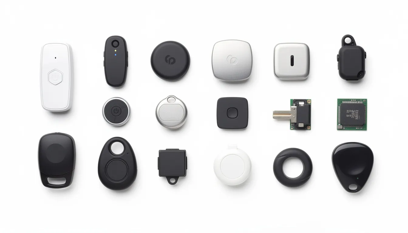
Here are the main categories you’ll encounter:
- Hard-wired vehicle trackers: These GPS devices connect directly to a car, van, or truck’s power supply and sometimes integrate with the CAN bus or OBD-II port for additional vehicle data. They’re typically installed behind the dashboard and draw power continuously, making them ideal for commercial fleets where permanent installation is preferred.
- Plug-and-play OBD-II trackers: Small devices that plug into a vehicle’s diagnostic port (standard on most cars and light trucks since the late 1990s). They’re easy to install and remove in seconds, require no wiring, and draw power from the vehicle. Good for small fleets or personal vehicle tracking.
- Battery-powered asset trackers: Rugged, sealed units with long-life batteries designed to last months or even years between charges. Used on trailers, shipping containers, generators, or construction equipment where wired power isn’t available. Often designed to withstand harsh conditions with IP67/IP68 ratings.
- Personal and wearable trackers: Compact GPS devices for tracking children, elderly relatives with dementia, lone workers in hazardous jobs, or pets. Typically include SOS buttons for emergencies and built-in rechargeable batteries that last one to several days per charge.
- Satellite-based trackers: Devices using satellite modems (like Globalstar or Iridium) instead of cellular networks. Essential for tracking assets in remote regions without cellular coverage, such as mining equipment in the outback or shipping containers crossing oceans.
Some GPS systems offer hybrid designs that use cellular networks when available and fall back to satellite transmission in dead zones, ensuring continuous coverage regardless of location.
Common uses of GPS trackers
GPS tracking is now standard in many industries and everyday life, from logistics and construction to family safety and outdoor recreation. The technology has matured to the point where real-time tracking of almost anything is practical and affordable.
Here are the most common applications:
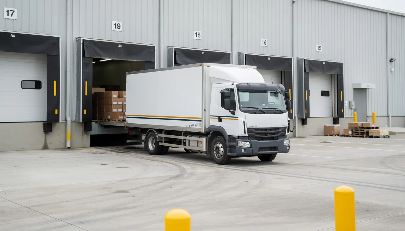
- Vehicle and fleet tracking: Companies monitor delivery vans, freight trucks, taxis, and service vehicles to know their precise location, routes driven, and time spent at each stop. A courier company with 20 vehicles in a large city can see every van’s position, dispatch the nearest driver to new pickups, and give customers accurate delivery windows.
- Asset and equipment tracking: Asset trackers on trailers, containers, rental machinery, and high-value tools help prevent theft and loss. Construction companies know exactly which job sites their equipment is on, reducing time spent searching and preventing unauthorized use.
- Personal safety and family tracking: GPS tracking devices and smartphone apps share live locations of children walking to school, elderly relatives with memory conditions, hikers exploring backcountry trails, and lone workers in isolated locations. Many include SOS buttons that send immediate alerts with the exact location.
- Theft recovery: Hidden trackers in cars, motorcycles, and construction equipment help police quickly locate stolen property. In many cases, a stolen SUV can be recovered within an hour thanks to its GPS location being shared with law enforcement.
- Precision agriculture: Farmers install GPS trackers on tractors and harvesters to monitor fuel usage, track working hours, and enable parallel driving paths that eliminate overlaps and gaps in planting or spraying operations.
- Last-mile delivery and logistics: Delivery companies rely on GPS data for route efficiency, ensuring timely deliveries, and providing customers with accurate tracking links showing their package’s journey.
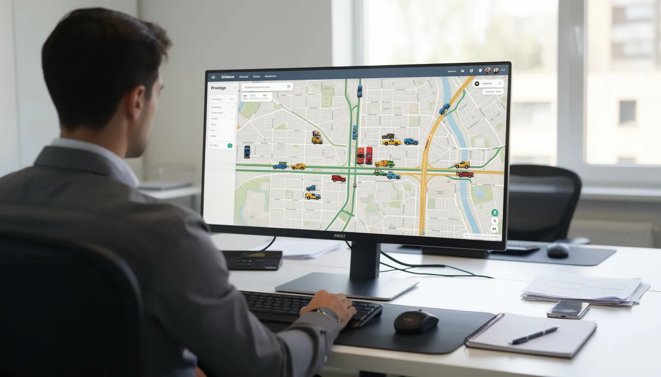
GPS tracking for fleets and businesses
For companies operating commercial vehicles, GPS tracking is typically integrated into broader fleet management software or telematics platforms. This creates a comprehensive system for managing vehicles, drivers, and operations from a single dashboard.
Here’s how fleet managers use GPS tracking day-to-day:
- Real-time dispatch: Dispatchers view all fleet vehicles on a map and assign the closest available vehicle to new jobs, reducing response times and fuel consumption
- Customer communication: GPS-based ETAs let businesses update customers with accurate arrival windows, improving customer satisfaction and reducing “where’s my order?” calls
- Trip history analysis: GPS data shows exact routes driven, idling time at each stop, unauthorized detours, and after-hours vehicle use, enabling managers to improve policies and address misuse
- System integration: GPS data can be paired with fuel cards to verify that fuel purchases match vehicle location, with maintenance software to schedule service based on mileage, or with electronic logging devices for hours-of-service compliance
Key benefits of using a GPS tracker
GPS trackers provide benefits across visibility, efficiency, security, compliance, and safety for both businesses and individuals. The value comes from transforming uncertainty about location into actionable data.
Here are the primary benefits:
- Improved visibility and control: Know where vehicles and assets are at any moment. See which routes were taken and have accurate time-stamped records of all movements. This eliminates guesswork and “he said, she said” disputes about locations and arrival times.
- Operational efficiency gains: Optimize routes to reduce kilometers driven, cut idle time, consolidate stops, and use historical data to design smarter schedules. Fleet managers often find significant waste when they first see actual vs. planned routes.
- Safety and driver behavior monitoring: Identify harsh braking, speeding, or aggressive acceleration events. Use this driving behavior data for coaching and risk reduction programs that improve driver safety and reduce accident rates.
- Security and theft prevention: Set up geofencing alerts when an asset leaves a designated area, receive after-hours movement notifications, and enable quick recovery of stolen vehicles or equipment. The deterrent effect alone often justifies the investment.
- Customer service improvements: Provide precise ETAs, send proactive notifications about delays, and offer transparent tracking links for deliveries. Customers increasingly expect this level of visibility.
- Cost reduction: Lower fuel consumption through better routing, reduce overtime costs with more accurate time records, minimize unauthorized personal use of company vehicles, and prevent expensive breakdowns through maintenance scheduling tied to actual odometer readings or engine hours.
- Fleet safety and compliance: Document that vehicles were where they were supposed to be, when they were supposed to be there. This protects businesses in liability situations and simplifies regulatory compliance.
How accurate is a GPS tracker?
Under open sky conditions, civilian GPS receivers commonly achieve around 2-5 meters (6.6-16 feet) of location accuracy. This is sufficient for most vehicle and asset tracking applications where you need to know which road a vehicle is on or which property an asset is located at.
Several factors influence location accuracy:
- Satellite geometry: The arrangement of visible satellites in the sky affects precision. When satellites are spread across the sky, accuracy improves. When they’re clustered in one area, accuracy degrades.
- Signal blockage: Tall buildings, dense tree canopy, tunnels, and indoor environments can block or reflect satellite signals, reducing accuracy or causing temporary positioning gaps.
- Atmospheric conditions: Heavy weather can slightly affect signal transmission, though the impact is usually minimal for civilian applications.
- Receiver quality: The GPS chipset and antenna quality in the tracking device affects how well it can acquire and process weak signals.
In urban “canyons” with high-rise buildings on both sides of narrow streets, accuracy can temporarily degrade to 10-20 meters. Some GPS devices supplement satellite signals with cell tower positioning and Wi-Fi location data to improve results in challenging environments.
For most fleet tracking and asset tracking purposes, 2-5 meter accuracy is more than sufficient. You can easily determine which street a vehicle is on, which job site a piece of equipment occupies, or which parking lot a trailer is stored in. Survey-grade GNSS receivers can achieve centimeter-level accuracy, but these specialized devices are different from typical commercial fleet trackers and come at significantly higher costs.
Choosing the right GPS tracker for your needs
Selecting a GPS tracker depends on what you’re tracking, where it operates, how frequently you need data, and your budget and installation constraints. Taking time to evaluate these factors upfront prevents costly mistakes.
Here’s how to approach the decision:
- Identify your primary goal: Are you focused on real-time fleet tracking, theft recovery, long-term asset monitoring, personal safety, or some combination? Different priorities lead to different device choices.
- Evaluate power options: Hard-wired installation works best for commercial fleets with vehicles that run daily. OBD-II plug-in devices suit smaller operations or situations requiring easy removal. Battery-powered trackers are essential for trailers, equipment, or assets without accessible power.
- Check network coverage: If vehicles or assets travel through rural or cross-border areas, verify that the tracker’s cellular network has adequate coverage in those regions. For truly remote locations, satellite-based devices may be necessary despite higher costs.
- Compare software platforms: The tracking hardware is only part of the solution. Evaluate the accompanying software for map quality, ease of use, alert and reporting options, mobile app functionality, API integrations with other business systems, and customer support responsiveness.
- Understand total cost: Factor in hardware purchase or lease costs, monthly service fees for cellular data and software access, installation costs if professional mounting is required, and any additional charges for premium features or higher update frequencies.
The best GPS tracking system is one that matches your specific operational needs. A landscaping company tracking a dozen trucks has very different requirements than a construction firm monitoring heavy equipment across remote job sites.
Summary
A GPS tracker uses satellite signals to calculate location and sends that data to software for live monitoring. It replaces guesswork with precise, time-stamped location data you can access anytime. The main advantages are visibility, efficiency, security, and safety. Businesses use it to manage fleets and reduce fuel costs, while individuals use it to protect vehicles, equipment, or family members.
Key points:
- GPS trackers combine satellite positioning with cellular or satellite communication
- Active trackers provide real-time updates; passive models store data for later review
- Benefits include route optimization, theft prevention, safety monitoring, and better ETAs
- Choose a device based on what you’re tracking, available power, coverage area, and software features.
Frequently Asked Questions
How does a GPS tracker get its location?
A GPS tracker receives signals from multiple satellites orbiting Earth and calculates its position using trilateration. By measuring how long each signal takes to arrive, the device determines its latitude and longitude within a few meters of accuracy.
Do GPS trackers require a monthly subscription?
Most real-time GPS trackers require a monthly subscription because they use cellular networks to transmit location data to cloud-based software. Passive GPS trackers that only store data locally typically do not require ongoing service fees.
Can a GPS tracker work without cell service?
Yes, but with limitations. GPS tracking devices can still calculate location without cell service, but they cannot transmit data in real time until connectivity is restored. Many devices store trip data internally and upload it once signal returns.
How accurate is a GPS tracker?
Most civilian GPS trackers are accurate within 2–5 meters under open sky conditions. Accuracy may decrease in urban areas with tall buildings, heavy tree cover, or tunnels.
What’s the difference between active and passive GPS trackers?
Active GPS trackers send location updates in real time over cellular or satellite networks. Passive trackers store location data internally and require manual download later.
Posted by Kellie Kendall on Feb 25th 2026